


(EDITOR’S NOTE: Poole Creek may be Stittsville’s most important natural feature. It meanders from west to north east, crossing through neighbourhoods old and new, playing a crucial role in our community’s ecology. In the final part of this series, ecologist Nick Stow follows the creek as it crosses Hazeldean Road. There, it passes through one of Stittsville’s newest neighbourhoods, where it’s in the midst of a transformation from farmland to forest. All photos by Nick Stow.)
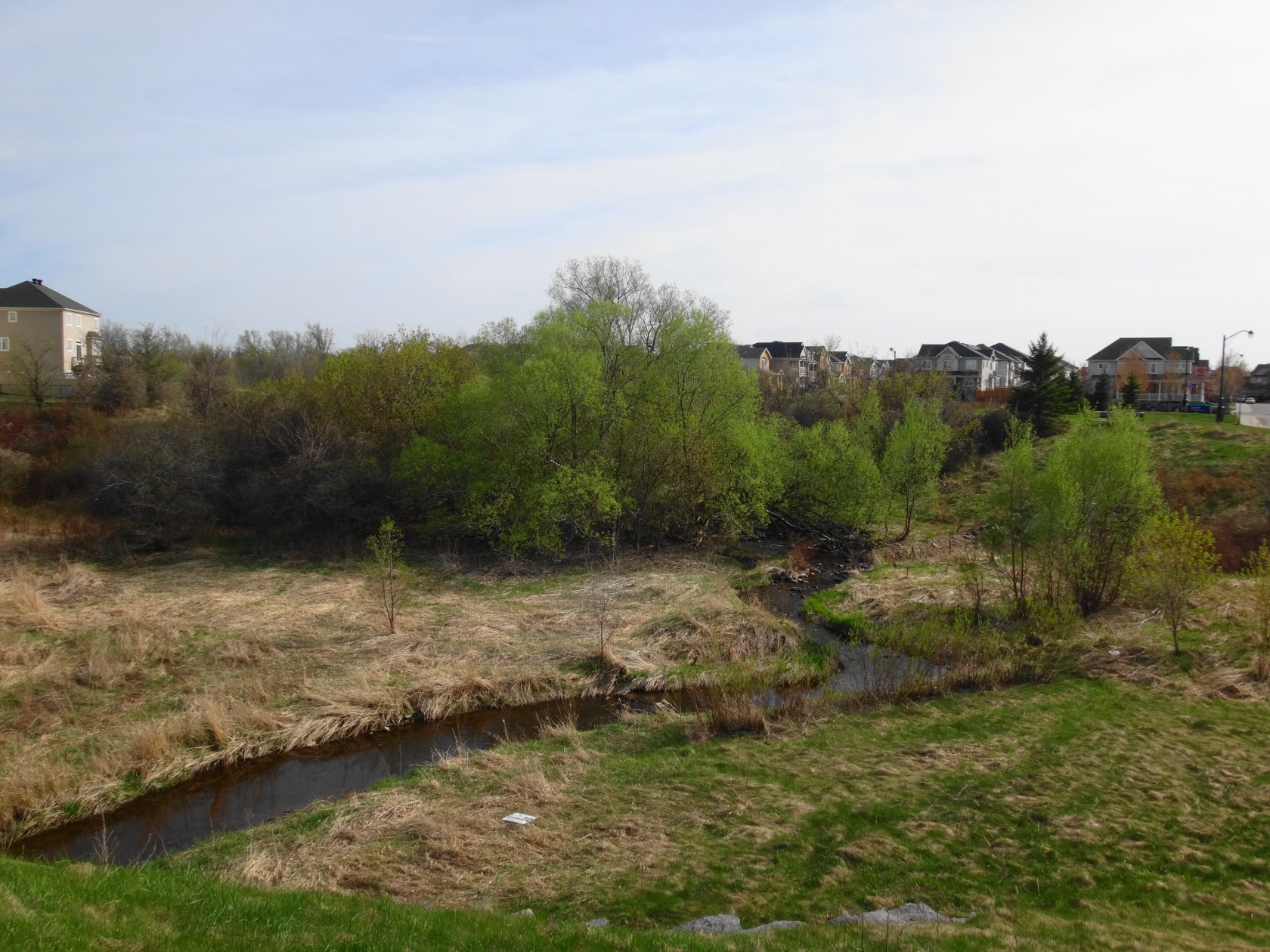
PAST SWEETNAM DRIVE, POOLE CREEK CHANGES CHARACTER AGAIN. After a short run out of sight, it crosses under busy Hazeldean Road and enters one of the City’s newest neighbourhoods. Where it once meandered through farmland, the creek nows winds between recent or still-developing subdivisions. Deeper, clay soils have allowed the creek to carve a valley dense in places with Manitoba maple, crack willow and thorny thickets. Following the creek becomes more difficult. With construction still underway, the trail remains incomplete. Good vantage points exist up and downstream of Huntmar Drive, beside one of the established subdivisions.
At first glance, the view in this area seems uninspiring. With a few exceptions, the creek exhibits little of the primordial wildness of the upper reaches. The nearby homes look down into the valley, which appears sadly exposed.

Such a perspective ignores what the creek has been and what it will become. In the past, when farmland lined the creek, the grassy valley provided pasture for farm animals, who would water in the creek, trampling and eroding the banks. Animals would defecate in the creek. Grazing maintained an open valley, exposing the creek to continuous sunlight and warming the water. Although much of Ottawa’s agricultural community has embraced new, sustainable animal husbandry, such conditions still exist in some other creeks in Ottawa’s rural area. We see the impacts as poor water quality, dismal aquatic habitat, and low native biodiversity.
Lower Poole Creek reminds me of the Don Valley, in North York, where I lived for year in 1975. I recall the matted grasses along the riverbank in the spring, when the ice had finally melted. I recall the dusty, dirt tracks on which we rode our bicycles, which turned to mud in the slightest rain. When I visited that same site in summer 30 years later, I did not recognize it. Where I’d known a wide, open, baking hot valley, I found a young forest and a cool, clear creek.
The same transformation will occur along lower Poole Creek. Already, the local developers, the City and the Conservation Authority have planted hundreds of trees, which will stabilize and shade the creek banks as they grow. They will plant more trees, and nature will play its own role, filling in the spaces. By the time that the children in the neighbourhood have their own children, they will marvel at the changes. A forest will fill the valley. Spring mornings will sparkle with birdsong, and along secret ways, wildlife will follow the water.

Poole Creek demonstrates why my fellow environmental planners and I fight so hard to conserve and restore urban creek and stream corridors. We often hear, “it’s just a ditch” or “it’s not worth protecting.” In almost every case, we find ourselves having to justify the few metres required to protect these places. We fight these battles not only because that’s our job, but because we see what these space will be in the future: places of refuge for people and wildlife, where children can explore, lovers can embrace, and fish hide in shaded pools.

(This story originally appeared on Nick Stow’s Naturally Ottawa blog and is republished here with permission. Stow is an ecologist and environmental planner and works for the City of Ottawa.)
There’s a problem with the vision. The 1976 GeoOttawa map shows many of the areas as unforested, likely due to the wetland ecosystem with high groundwater levels which don’t support trees, and has crops along the creek, not cows. It would require large herds to go beyond the usual drinking area.
The 2014 GeoOttawa map has dog access along the pathways and in some wetland areas. The plans for the ravine sections are to have pathways along top-of-bank and black chain link fences restrict public access. The environmentalists and park planners forget the creeks are being used for stormwater management. No children should be in a ravine which can flood quickly. Any raised pathway in the floodplain and the 100s of trees will remove floodplain storage and slow down the flows. Restoration projects to create “natural channels” result in removal of original habitat. Road crossings adversely impact wildlife. The corridor has also been narrowed in the Fairwinds and downstream area, the road and footbridge embankments removed floodplain storage, and more stormwater is being directed to Poole Creek and more will be in future, with no detailed analysis of the cumulative impact of all the changes. The Carp River Restoration Plan (CRRP) project is adding a pedestrian bridge across the mouth of Poole Creek – the pathway embankments will create a dam across it. Unless the City recognizes the need to restrict development on wetlands and wet lands and the impacts of trying to use natural systems for stormwater management, we will continue to have problems in future
Funny how Jackson trails use to be considered a wet land. I watched them back fill for days with crushed stone. That entire area was a marsh! Guess that part didn’t get protected!
Agreed!